
An initiative to map the entire bottom of the Great Lakes is gaining traction due to its potential benefits for fishing, shipping, and environmental management. Led by the Great Lakes Observing System, the project seeks to chart the lakebed, of which only 15% is currently mapped. This effort aims to uncover critical information about underwater topography, shipwrecks and infrastructure.
Media Landscape
This story is a Media Miss by the right as only 0% of the coverage is from right leaning media. Learn more
Left 36%
Center 64%
Right 0%
Bias Distribution Powered by Ground News™
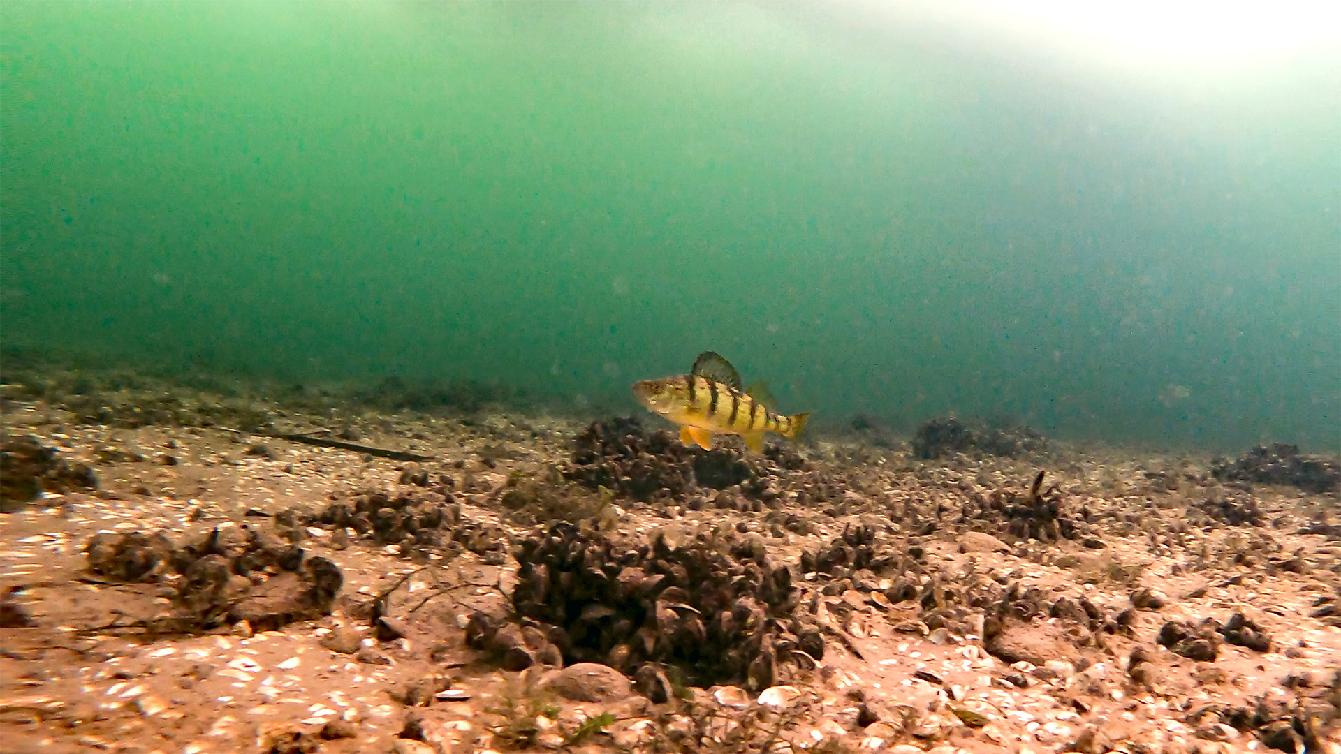
The Great Lakes’ diverse ecosystems are home to various species, and a comprehensive mapping could provide insights into the impacts of climate change, invasive species and pollution.

Point phone camera here
Using advanced sonar and robotic technology, scientists will scan the depths of the five lakes, which span over 94,000 square miles — an area nearly the size of Oregon — and hold 21% of the world’s freshwater.
A federal bill has allocated $200 million toward completing the mapping by 2030. Advocates of the project argue that it will not only help protect the lakes’ ecosystems but also enhance navigation safety.
Jack Aylmer
AN EFFORT IS UNDERWAY TO MAP THE ENTIRE BOTTOM OF THE GREAT LAKES- A PROJECT GAINING MOMENTUM DUE TO ITS POTENTIAL BENEFITS FOR FISHING, SHIPPING, AND ENVIRONMENTAL MANAGEMENT.
WITH ONLY 15% OF THE LAKEBED CURRENTLY MAPPED, THIS INITIATIVE, LED BY THE GREAT LAKES OBSERVING SYSTEM, AIMS TO REVEAL CRUCIAL DETAILS ABOUT UNDERWATER TOPOGRAPHY, SHIPWRECKS, AND INFRASTRUCTURE.
THE LAKEBED IS HOME TO DIVERSE ECOSYSTEMS, AND MAPPING IT CAN ALSO HELP SCIENTISTS UNDERSTAND THE IMPACTS OF CLIMATE CHANGE, INVASIVE SPECIES, AND POLLUTION.
ADVANCED SONAR AND ROBOTIC TECHNOLOGY WILL BE EMPLOYED TO SCAN THE LAKES’ DEPTHS.
THE FIVE LAKES SPAN OVER 94,000 SQUARE MILES-
AN AREA NEARLY THE SIZE OF OREGON-
AND CONTAIN OVER 20 PERCENT OF THE WORLD’S FRESHWATER
A FEDERAL BILL CALLS FOR COMPLETE MAPPING TO BE COMPLETED BY 2030-
WITH 200 MILLION DOLLARS BEING PUT TOWARDS THE PLAN.
ADVOCATES SAY THIS PROJECT WILL AID IN PROTECTING THE LAKE’S VITAL ECOSYSTEMS AND IMPROVE NAVIGATION SAFETY.
JACK AYLMER – STRAIGHT ARROW NEWS.
Media Landscape
This story is a Media Miss by the right as only 0% of the coverage is from right leaning media. Learn more
Left 36%
Center 64%
Right 0%
Bias Distribution
29 other sources covering this story
Total News Sources
29
Leaning Left
9
Center
16
Leaning Right
0
Last Updated
5 months ago
Bias Distribution Powered by Ground News™
Straight to your inbox.
By entering your email, you agree to the Terms & Conditions and acknowledge the Privacy Policy.
MOST POPULAR
-
 Getty Images
Democrats in Congress receive lowest approval rating in Quinnipiac poll history
-
 Getty Images
AG Bondi reviewing Epstein documents for release, could hold client list
-
 Getty Images
Speaker Johnson won’t support DOGE stimulus checks
-
 Reuters
UN chief reveals his plan for peace in Haiti to Caribbean leaders